
In this blog post, I give you my ideas for hikes of all levels and durations to discover the Alsatian Jura!
The Alsatian Jura, really?
Yes, even the Alsatians don’t usually believe it when they are told about it, but the Jura moutains are also in Alsace! It is located at the southern end of Alsace, at the border with Switzerland and reaches its highest point at 831 meters above sea level on the Raemelspitz in the Raemelsberg mountain range. It’s a small part of the massif (175 km2), but it’s enough to enjoy it and to have a change of scene.
I love the Vosges, but it’s also nice to change the atmosphere. Here, the sandstone gives way to limestone, it’s quite exotic! In addition, the Alsatian Jura is home to a great deal of biodiversity: many species of orchids and birds, but also lynx and forest cats live there.
1. Raemelsberg hike in the Alsatian Jura
I liked
- Magnificent panoramas
- The exotic side of the Alsatian Jura
- Small passage in Switzerland
- A bit sporty
I liked a little less
- Nothing!
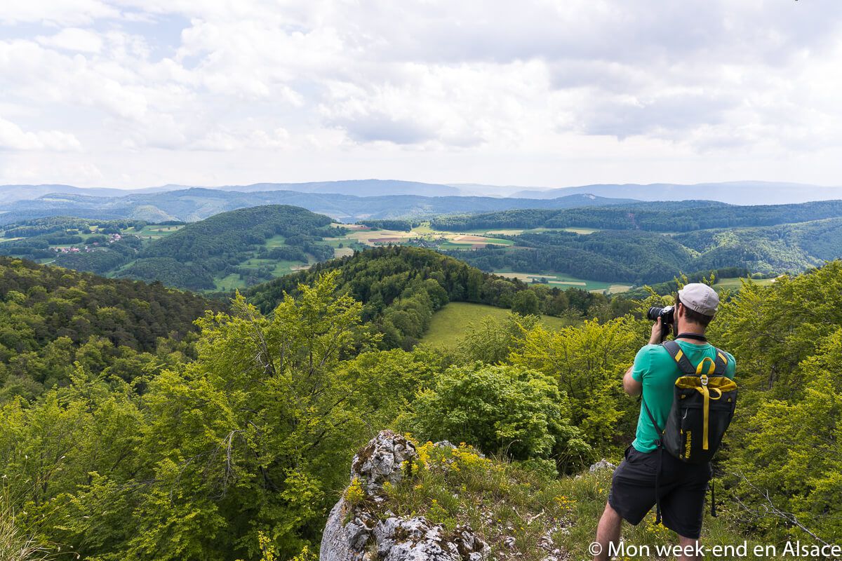
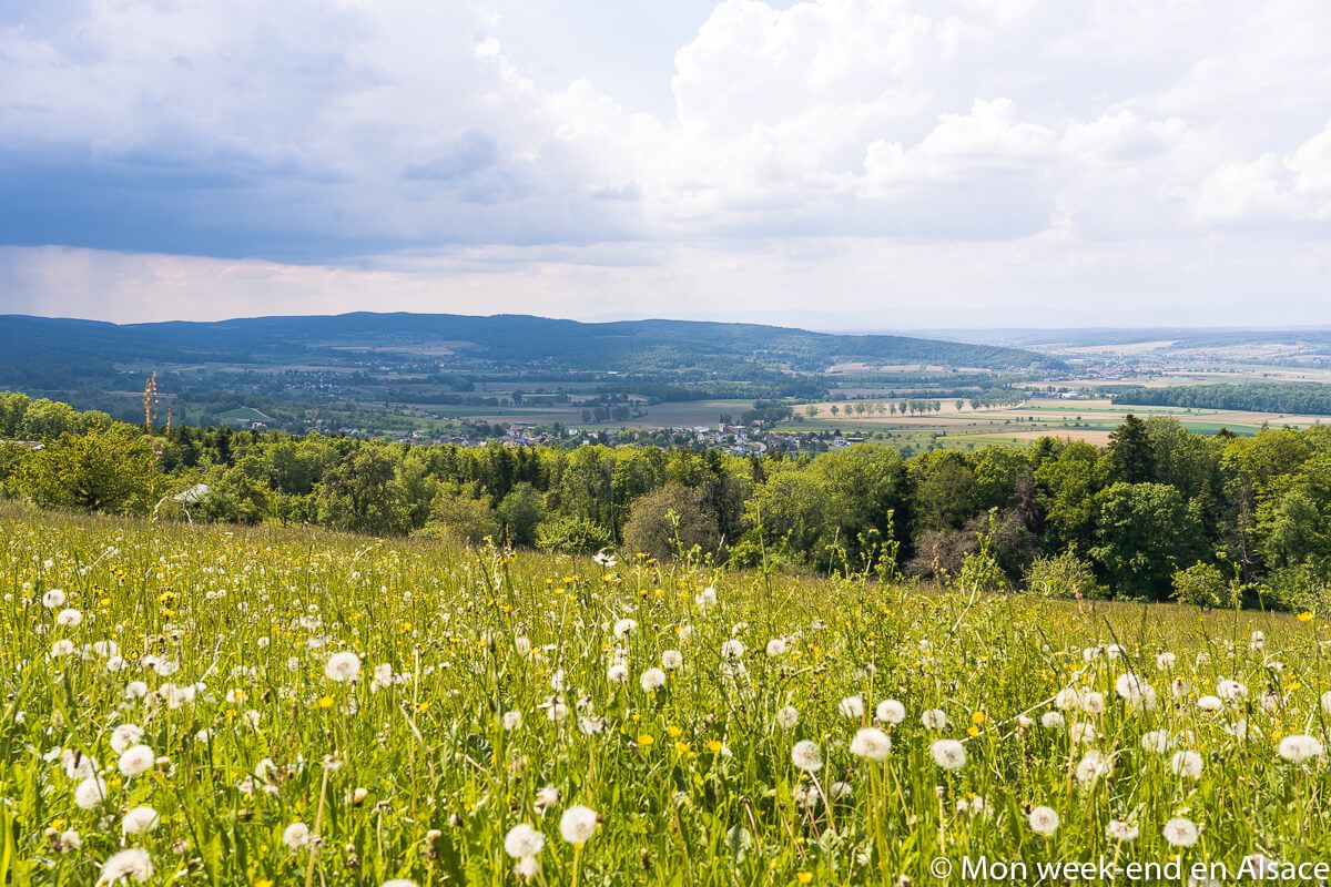
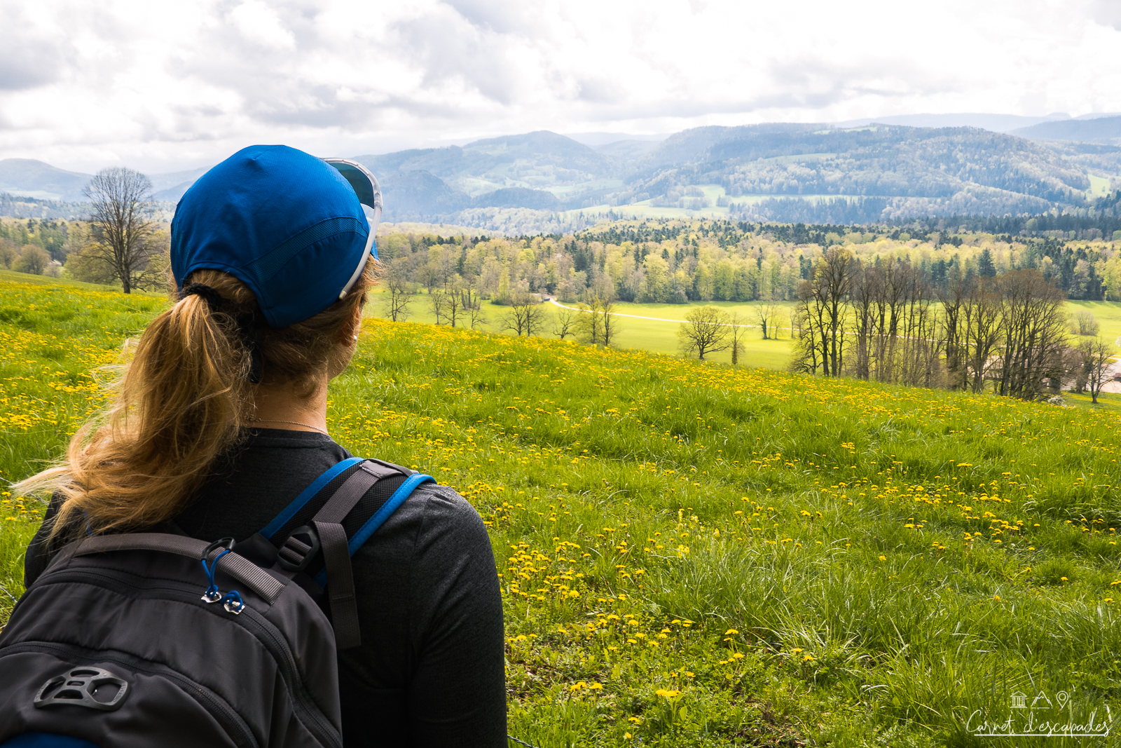
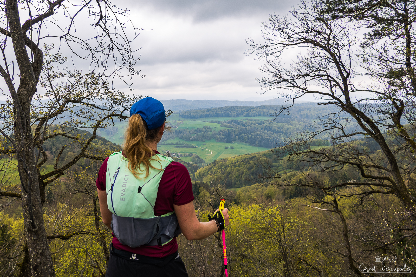
If you’re looking for a a slightly strenuous hike with beautiful panoramic views in the south of Alsace, look no further: I’ve got just what you need with this hike starting from Wolschwiller, in the Sundgau. This loop 11km, with 400m of ascent will take you to the Raemelsberg, the highest peak in Europe. Alsatian Jura.
This hike is a favorite because I found it very different from the Vosges sandstone (the limestone rocks typical of the Jura are very different from the Vosges sandstone) and because it allows to have magnificent viewpoints, both on the Alsatian and on the Swiss side! I also liked the fact that I made a small incursion into Switzerland, which added to the exotic side of the trip.
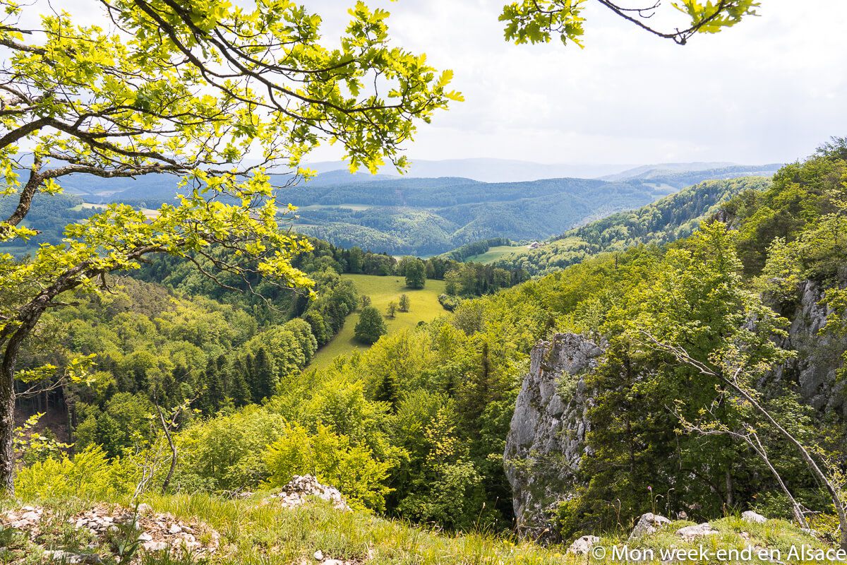
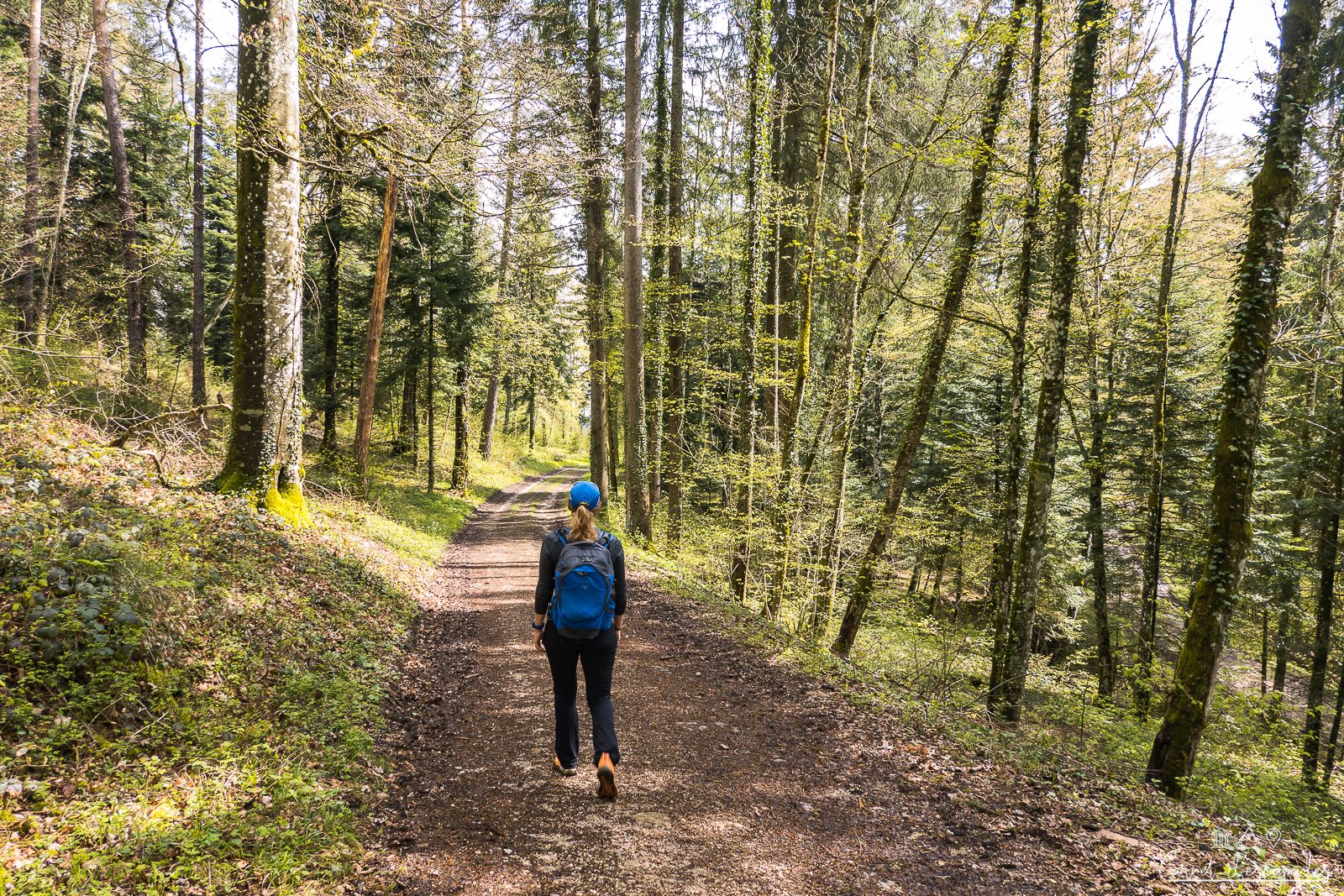
Climbing in the forest of Wolschwiller
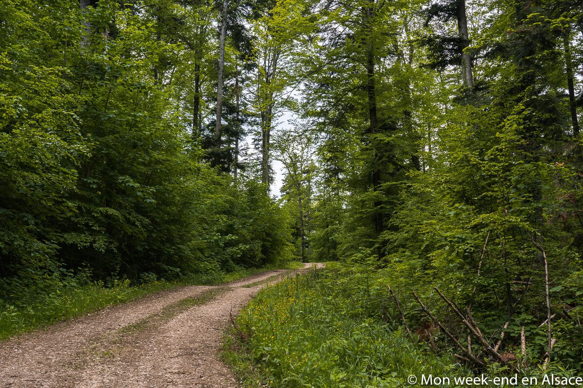
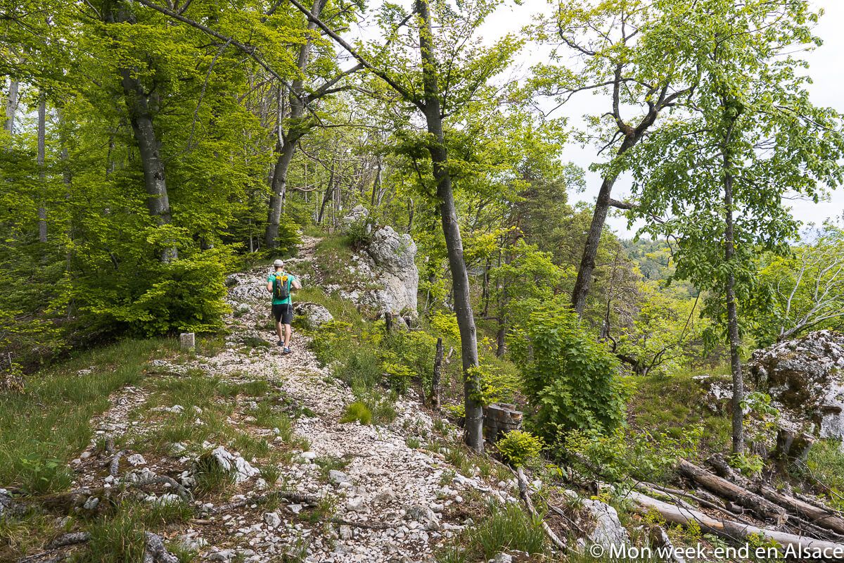
Starting from Wolschwiller, the hike quickly leaves the village to reach the forest biological reserve where Great Horned Owls were reintroduced in the 1970s and which is home to a wide variety of birds, but also lynx and forest cats! Incredible, isn’t it? It is there that the walk is going to be the hardest since we go up in direction of the crest. But hey, you have to earn a view, right?
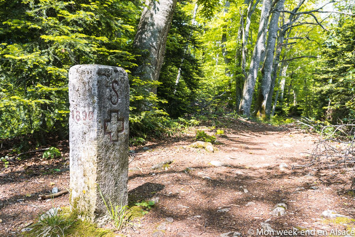

The Raemel chain, border between France and Switzerland
Once arrived at the top, we quickly notice large markers, which are in fact border markers marking the limit between France and Switzerland. This is also why this path is called the path of the customs officers or smugglers… One can imagine that goods could have crossed the border at this place in all discretion!
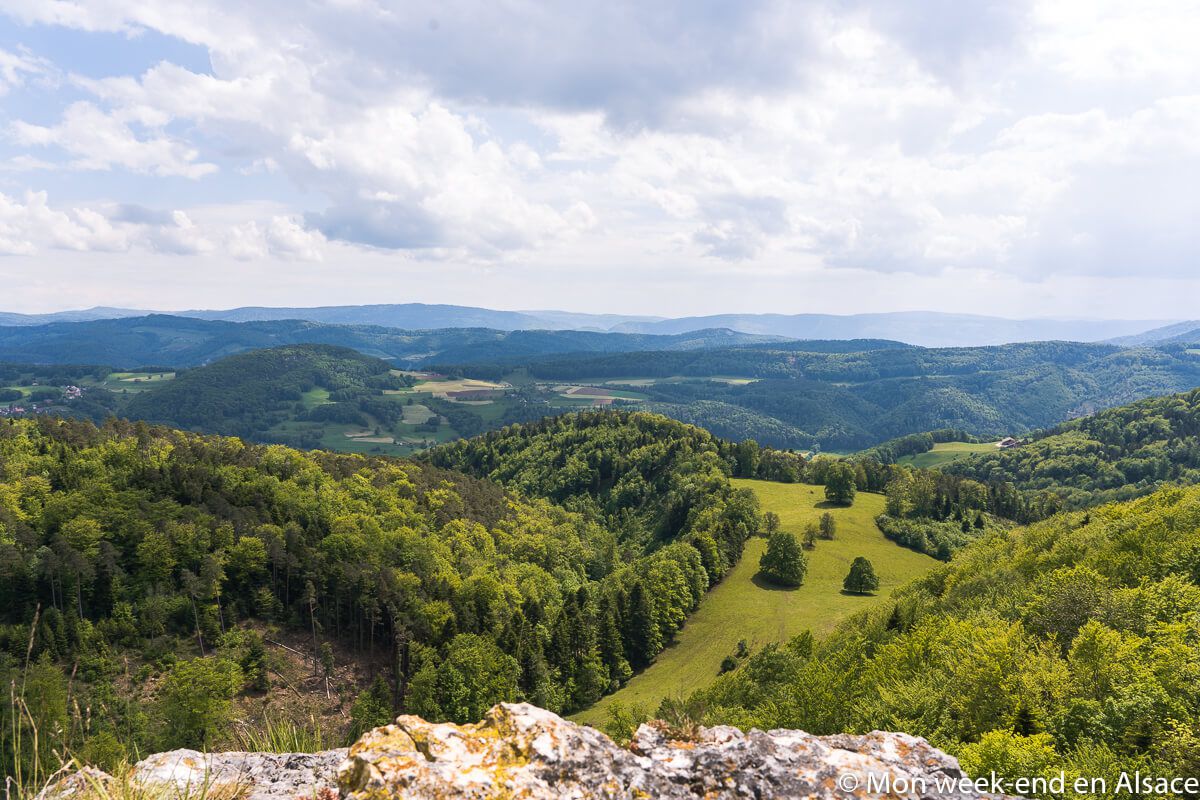
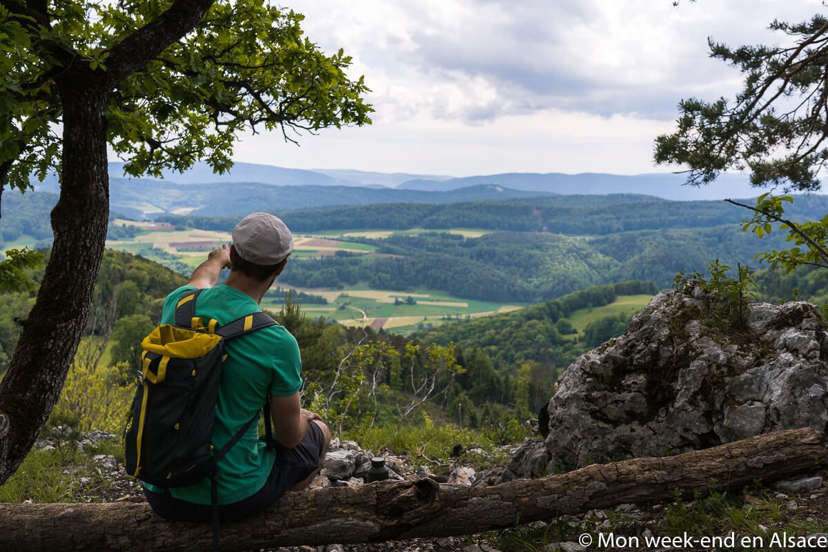
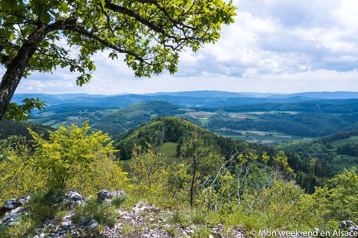
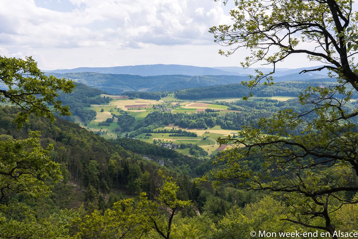
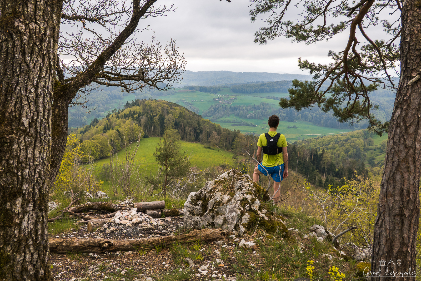
From there, I bet you will stop every 2 minutes to admire the view, especially on the Swiss side because it is the most open. The views of the surrounding area are just beautiful and it’s worth taking breaks to admire them!
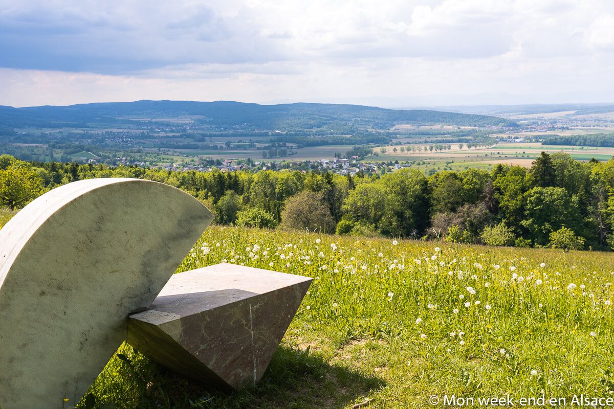
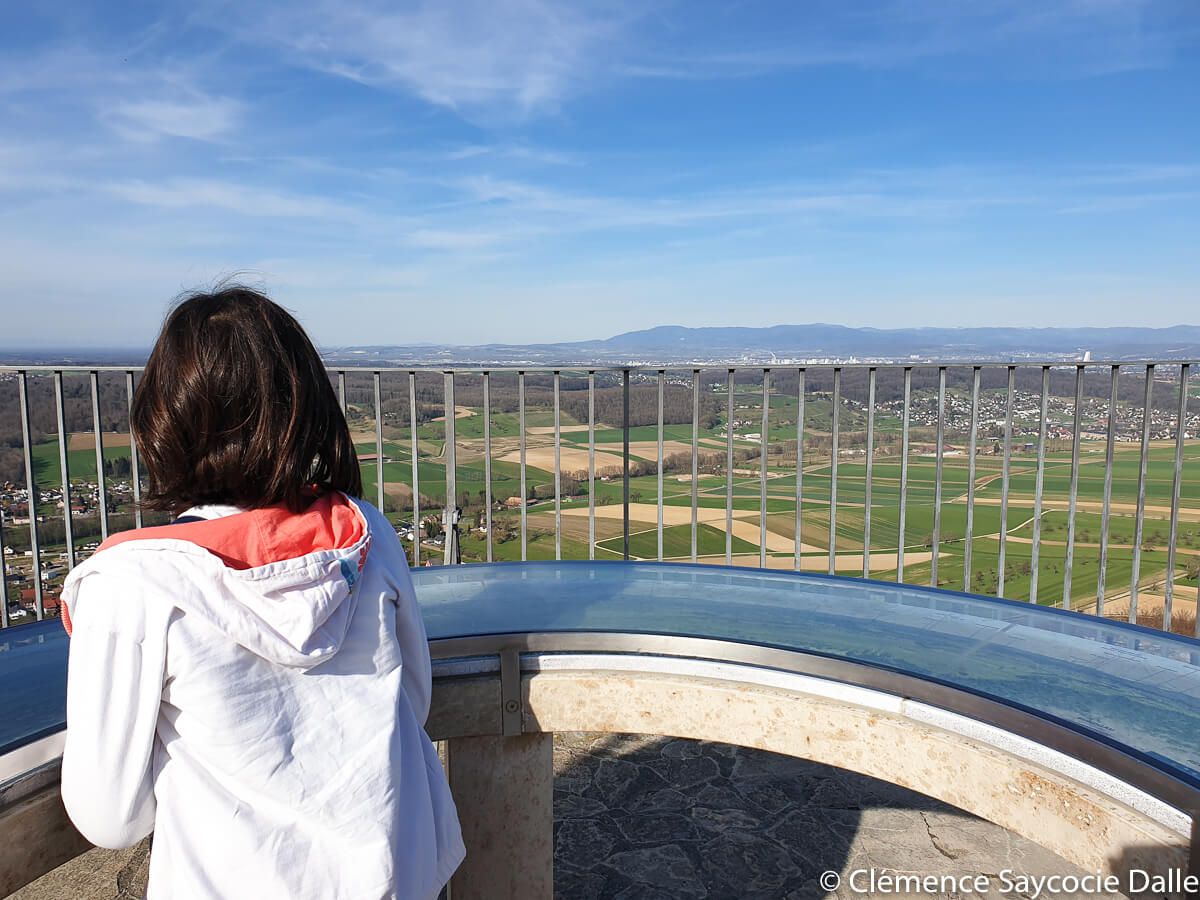
The Raemelspitz, highest point of the Alsatian Jura
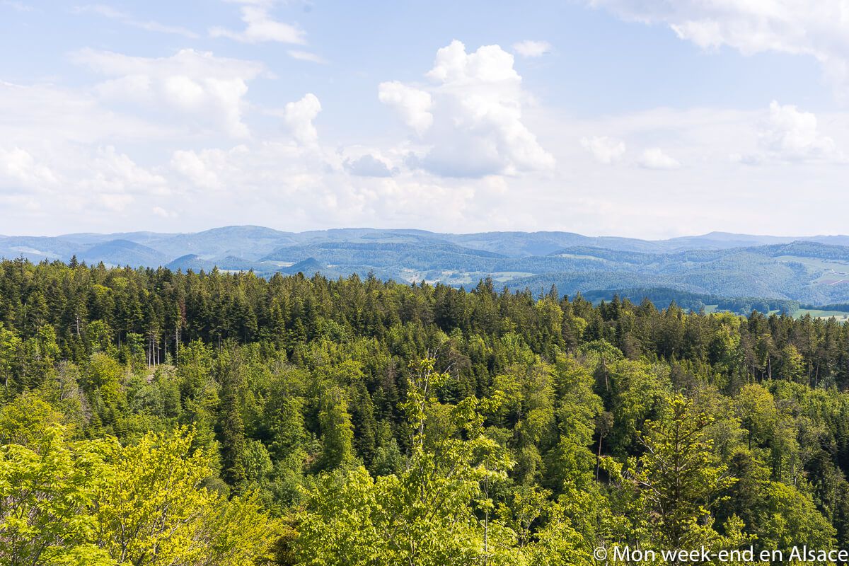
Walking along the ridge path, you reach the Raemelspitz, the highest point of the Sundgau and the Alsatian Jura at 832m. Ok, it is not very high, but the view is nevertheless crazy since we can admire the Vosges on the French side, the Jura on the Swiss side, the Black Forest on the German side and even, by clear weather, the Swiss Alps with in particular the famous summit of the Jungfrau.
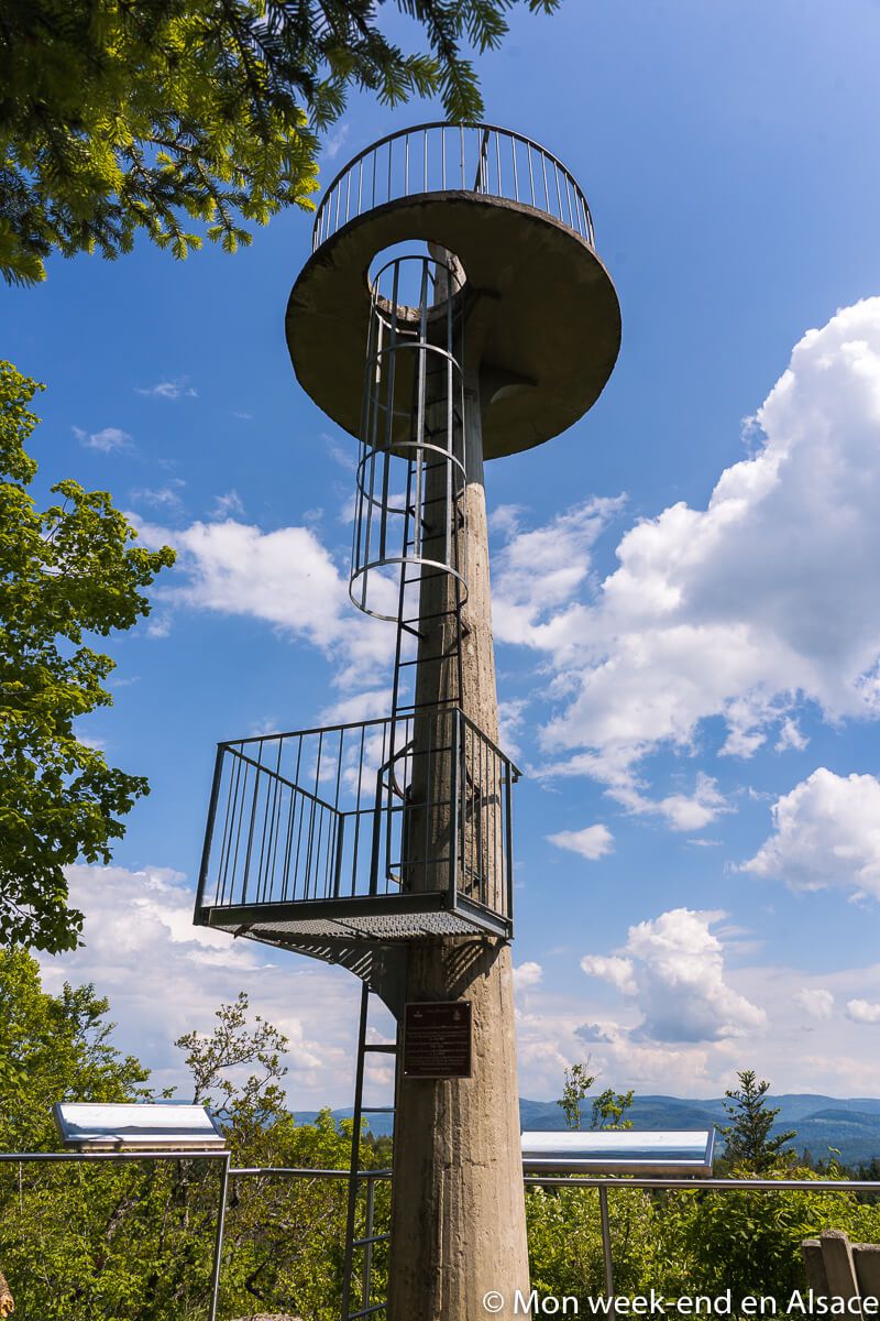
If you want to get even more height, you can climb the concrete tower installed by the Swiss on the Raemelspitz before the First World War in order to keep an eye on the surroundings. We go up there by ladders, you must not be afraid of heights… I only went up to the first platform, I didn’t have the courage to continue, especially since the view was already fully satisfactory 😉

An amazing sculpture on the Rittimatte
Continuing towards the village of Burg-im-Leimental in Switzerland, we pass by the Rittimatte, a large clearing where there is an amazing sculpture. At first glance, it looks like a cheese, but make no mistake, it is… an LSD pill! Yes, I’m not kidding! This one was indeed installed in homage to Albert Hofmann, a chemist from Burg who discovered LSD. Really amazing!
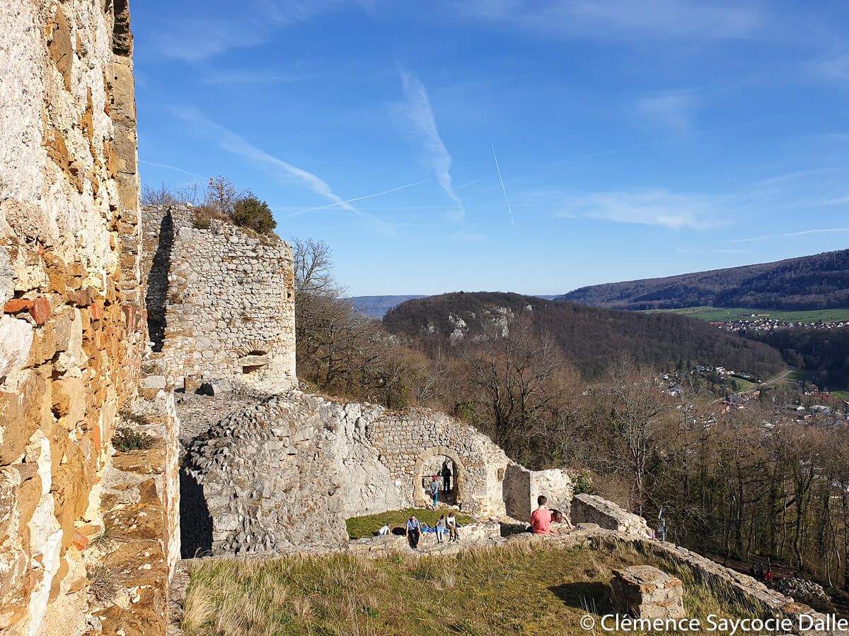
Burg Castle
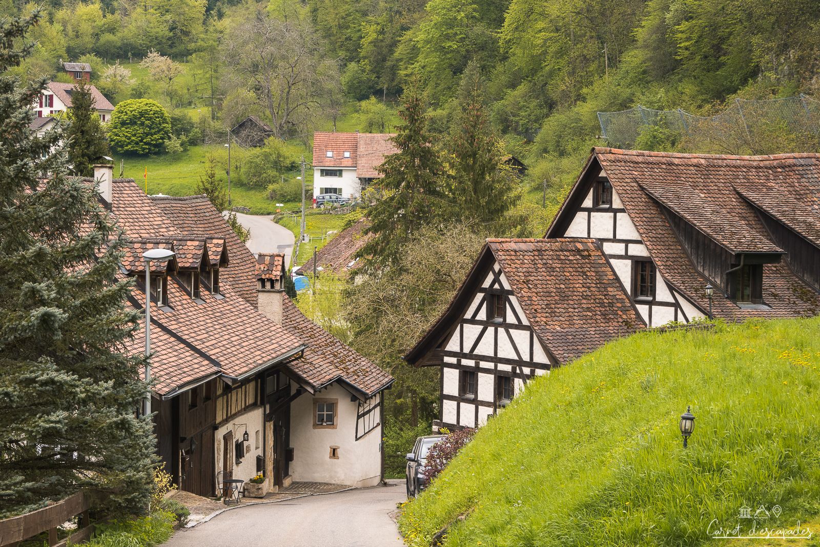
We then quickly arrive at the village of Burg, in Switzerland. (Again) a surprise awaits you: a beautiful castle suddenly seems to appear from nowhere! Then you just have to cross the village and take a path in the forest to come back to the starting point.


Practical information
Itinerary
This idea of hike is part of the Sundgau walking circuits. You can find the route directly on the website of the Tourist Office (where you can also buy the paper topoguide with 17 routes)
Departure and arrival
The departure and arrival are in front of the town hall of Wolschwiller.
Features
- Distance: 11km
- Elevation gain: about 400m
- Duration: about 3h30
Hungry?
In the neighboring village of Lutter, the Auberge Paysanne is a good address!
Access
By car
Wolschwiller is located in:
- 53km from Mulhouse (about 45 minutes)
- 82km from Colmar (about 1h)
- 153km from Strasbourg (about 1h45)
By public transport
This is not possible :-/
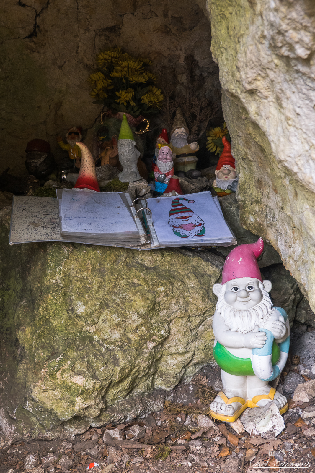
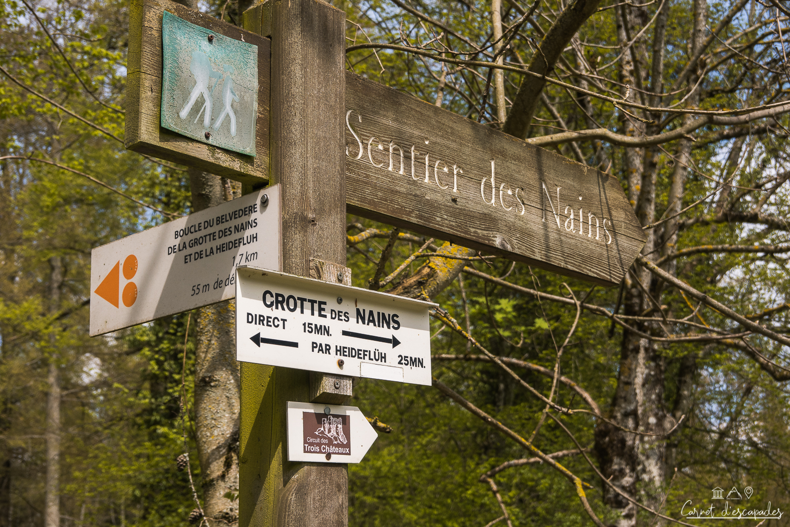
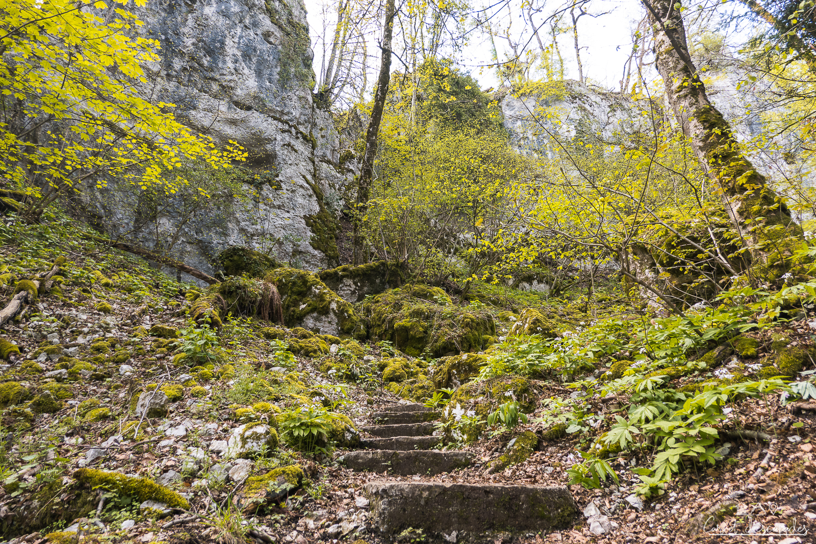
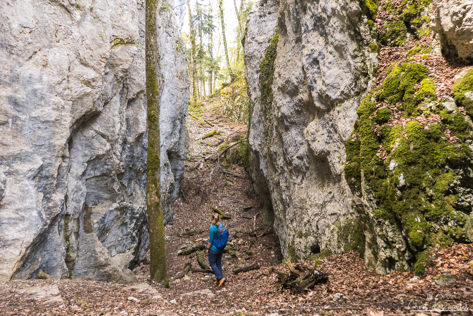
2. Walk to the Grotte des Nains in Ferrette
I liked
- Unusual cave
- Huge limestone rocks
- Very exotic for Alsace!
I liked a little less
- Nothing!
The cave of the Dwarfs is, with the castle of Ferrette, one of the inescapable of a discovery of Sundgau and the Alsatian Jura. It’s easy to get there but the place is spectacular and really worth a visit! I’ve already been there several times and it’s a place I adore and highly recommend.
Legend of the Dwarves of Ferrette
The Dwarves’ cave is not called that because garden gnomes are now enthroned there! Its name is linked to a Sundgau legend (click to read it).
The limestone rocks of the Grotte des Nains
When you arrive on the spot, you can be surprised by the small size of the cave of the Dwarfs, which has nothing spectacular: a crack opening in the rock wall, in which we find garden gnomes (!) .
But one comes to the dwarfs’ cave for the cave, but also (and especially I would say!) for the spectacular landscapes that surround it. Huge limestone rocks, typical of the Alsatian Jura and totally different from the Vosges sandstone that we know well in Alsace, form a gorge of about 35 meters high called Erdwibalaschlucht (the parade of the little women of the earth). It was formed by the work of water in the karstic limestone.
Above the gorge, you can reach the Plateau des Nains, also called Erdwibalafelsen (Fairy Rock), which offers a beautiful panorama on the Ill valley and the villages of Bouxwiller and Werentzhouse. For climbing enthusiasts, it is also a favorite spot!


Family walks or hiking, your choice!
To discover the Grotte des Nains, you can choose between different walks of varying lengths:
- the shortest (suitable for all-terrain strollers): park on the parking lot of the Keucht located in the forest. Take the direction of Sondersdorf and, a little before the exit of the village, take on your left the forest path indicated by a wooden sign “Sentier des Nains”. Continue to the parking lot located a few hundred meters away. From the parking lot, it’s a 15-20 minute walk.
- the little walk: park on the parking lot of the Community of Communes in Ferrette (3A route de Lucelle) and take the red diamond trail along the road towards Sondersdorf. Count 30 to 35 min to reach the cave (1,8km).
- hiking: you can make a very nice loop from the village of Ferrette to discover the Grotte des Nains, the castle of Ferrette but also beautiful viewpoints like the Heindenfluh (my favorite!). Find the infos here.
Practical information
Access
By car
Ferrette is located in:
- 55 km from Mulhouse (about 50 minutes)
- 83 km from Colmar (about 1h10 minutes)
- 157 km from Strasbourg (about 1h50)
By public transport
You can calculate your route on Fluo Grand Est.
3. Rando itinérante – 3 castles in the Alsatian Jura
I liked
- Variety of landscapes
- Exciting and little known hike in Alsace
- Possible transport of luggage
- Friendly welcome from the hosts
I liked a little less
- Nothing!
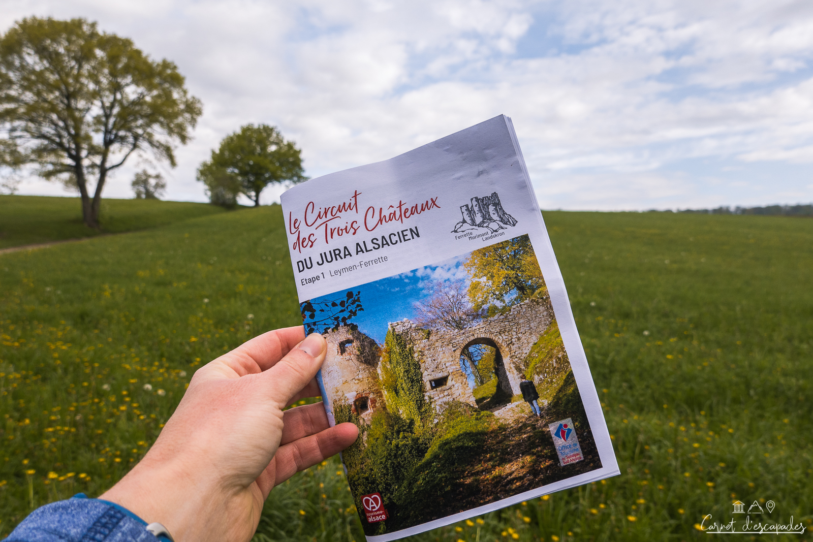
I tried out the Circuit des 3 Châteaux du Jura alsacien, a 4-day loop hike exploring the Sundgau region of southern Alsace. The least we can say is that I was not disappointed: it is a superb hike to do in Alsace!
4 days of hiking in a loop
The circuit of the 3 castles of the Alsatian Jura is 85km long, with about 2 750m of positive altitude difference. It is thus rather reserved for good walkers, but it is also possible to cut the itinerary a little if it seems too much to you but you still want to hike there a few days. The itinerary forms a loop, which makes it easy to get back to the starting point (and eventually to your car). But the good news is that the start and finish of the hike can also be reached by public transport thanks to the Basel streetcar serving Leymen. Really practical!
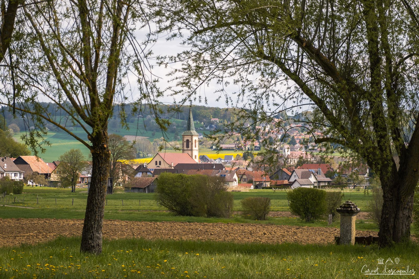
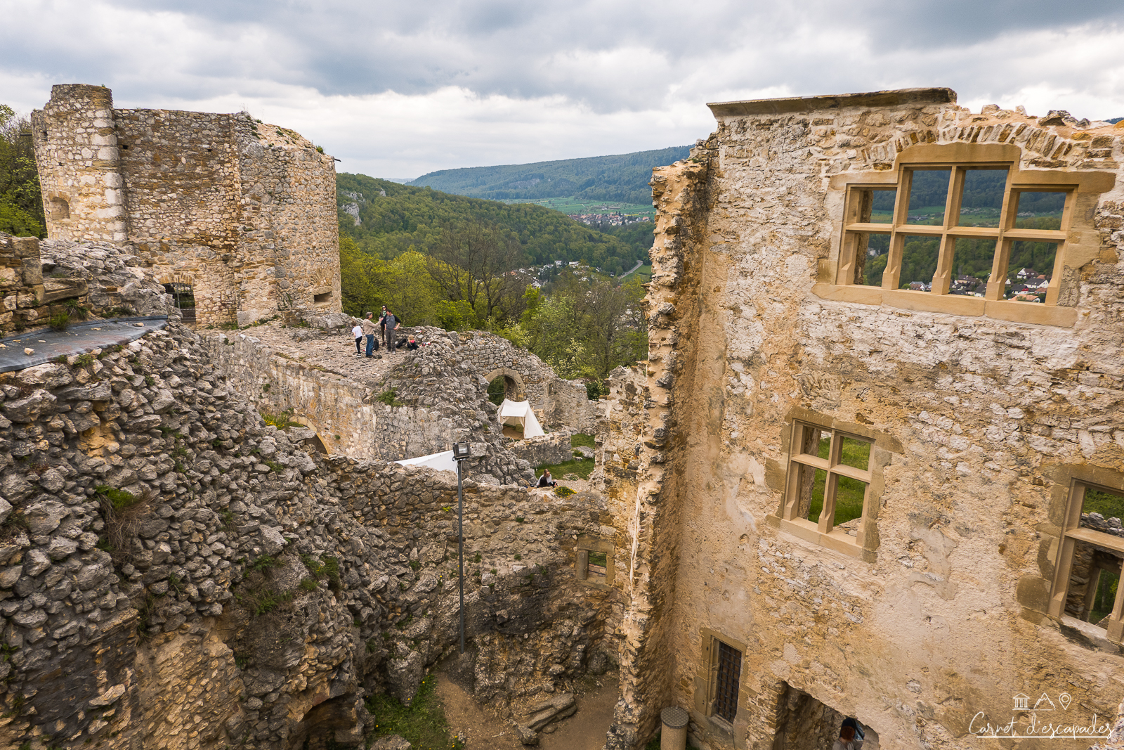
The landscapes offered by the hike are varied: we go from the meadows and hills of the Sundgau to a much more mountainous atmosphere in the Alsatian Jura, with rocks, slopes and beautiful ridge lines! There are also, as the name of the hike indicates, beautiful castles to admire along the way: the castles of Ferrette, the Morimont and the Landskron are ruins, but they are still beautiful and offer incredible views of the surrounding area.
Moreover, I liked the fact that we went along the Swiss border and even made a little incursion, it’s fun. This is one of the strong points of this hike in my opinion: it offers a beautiful variety of landscapes and atmospheres, we really don’t suffer from monotony!


Easy to organize
This hike is easy to organize. You will have to contact the three hotels one by one, but the accommodations offer special rates to hikers and provide a multitude of services. It is thus possible to reserve your night and breakfast, but also half-board, the picnic of the following day, and even the transport of luggage! It is very pleasant to hike with only a small bag for the day! I tested it and loved it 🙂
So, tempted?
For more information, read my detailed article about my 4 days hiking in the Alsatian Jura on my blog Carnet d’escapades (only in French) Difficulties, stages, accommodation… I give you all the information to prepare your hike! Of course, you can also visit the website of the Sundgau Tourist Office, where you will find all the practical information as well as the GPX track.
Practical information
Itinerary
For practical information and a GPX trail, visit theSundgau Tourist Office website. See also my detailed article on my 4-day hike in the Alsatian Jura on my other blog Carnet d’escapades.
Departure and arrival
The departure and arrival are in Leymen (but it is possible to start from elsewhere).
Features
- Duration: 4 days
- Distance: 80/85km
- Elevation gain: 2 750m
Access
By car
Leymen is located in:
- 48km from Mulhouse (about 45 minutes)
- 75km from Colmar (about 1h)
- 145 km from Strasbourg (about 1h40)
By public transport
You can reach Leymen by streetcar from Basel station. You can calculate your route on Fluo Grand Est.
4. Hiking from Leymen to Mariastein
I liked
- The length of the ride is suitable for everyone
- Cultural stops along the route, for the whole family
- Discover castle ruins and a unique chapel in the same walk
- The bi-national route
I liked less
- Unfortunately, I did not have time to explore all the facets of Mariastein, because otherwise we would have had to cross the forest in the dark…
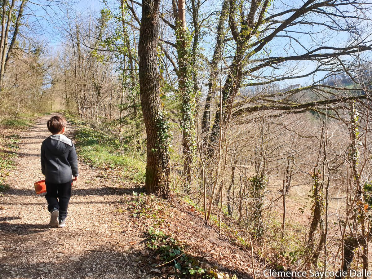
I’m taking you on a family outing from Leymen to Mariastein, between Alsace and Switzerland, 15 km from Saint-Louis and Basel, which satisfied both my desire for fresh air and my curiosity! The Sundgau is full of little-known treasures. Leymen is no exception to the rule, especially when the village is associated with its neighbor in the canton of Solothurn, Mariastein. The hike starts in Leymen, near a small chapel, on the same path as the Landskron castle trail.
Let’s go!
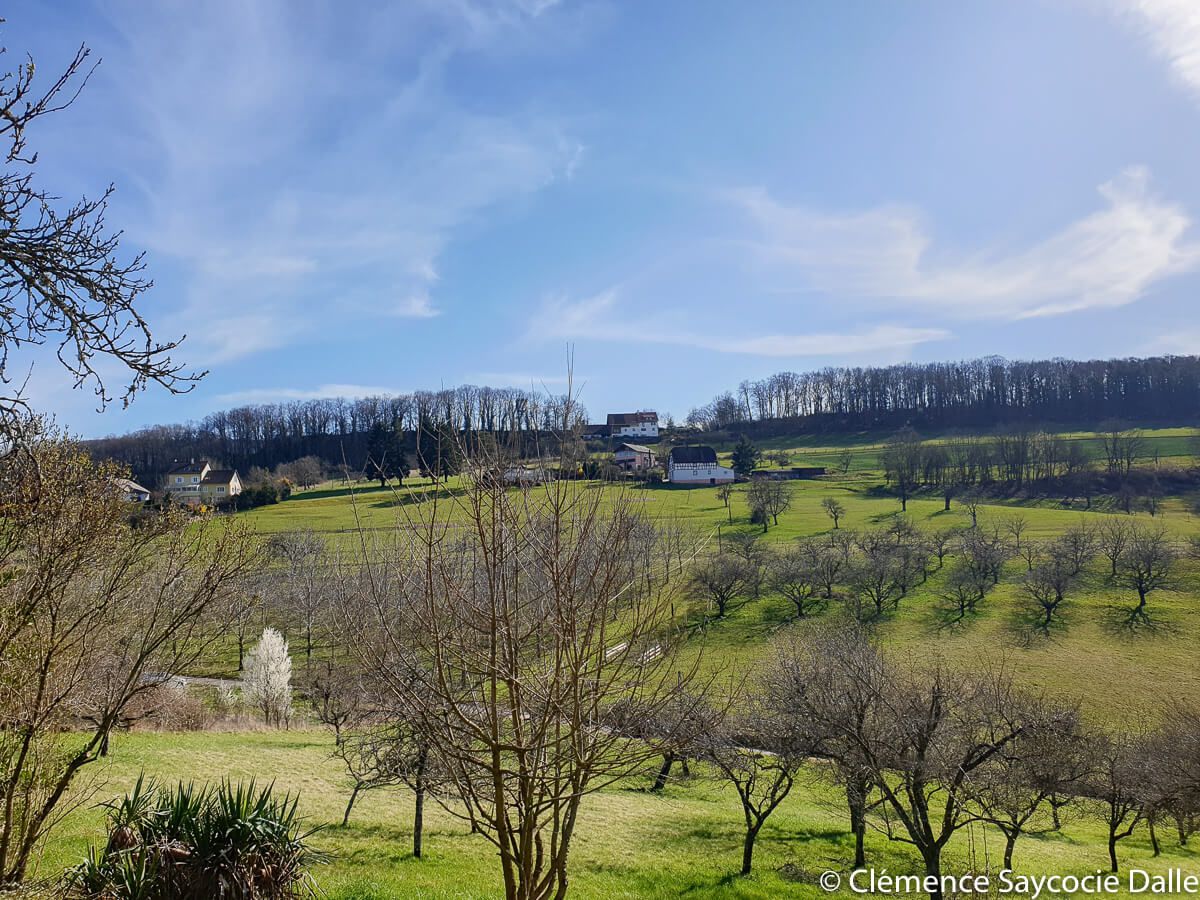
We first pass in front of an old quarry forbidden to the public but which is impressive, even seen from far. Then, we begin the (soft) rise towards the castle. After having passed to the edge of the forest, we skirt a meadow where the tower of Landskron is drawn, and we pass by a hamlet to continue our rise which intensifies a (very little). Here, the houses are charming, with the air of second homes! But it is the perched hut, in the middle of the meadows, that caught the eye of the kids the most. Of course!
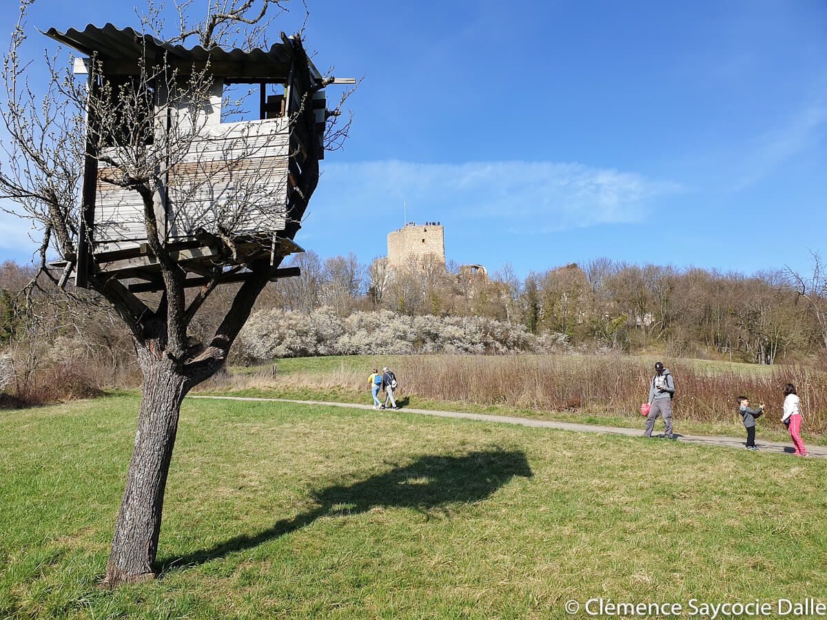
Landskron Castle and its fascinating history
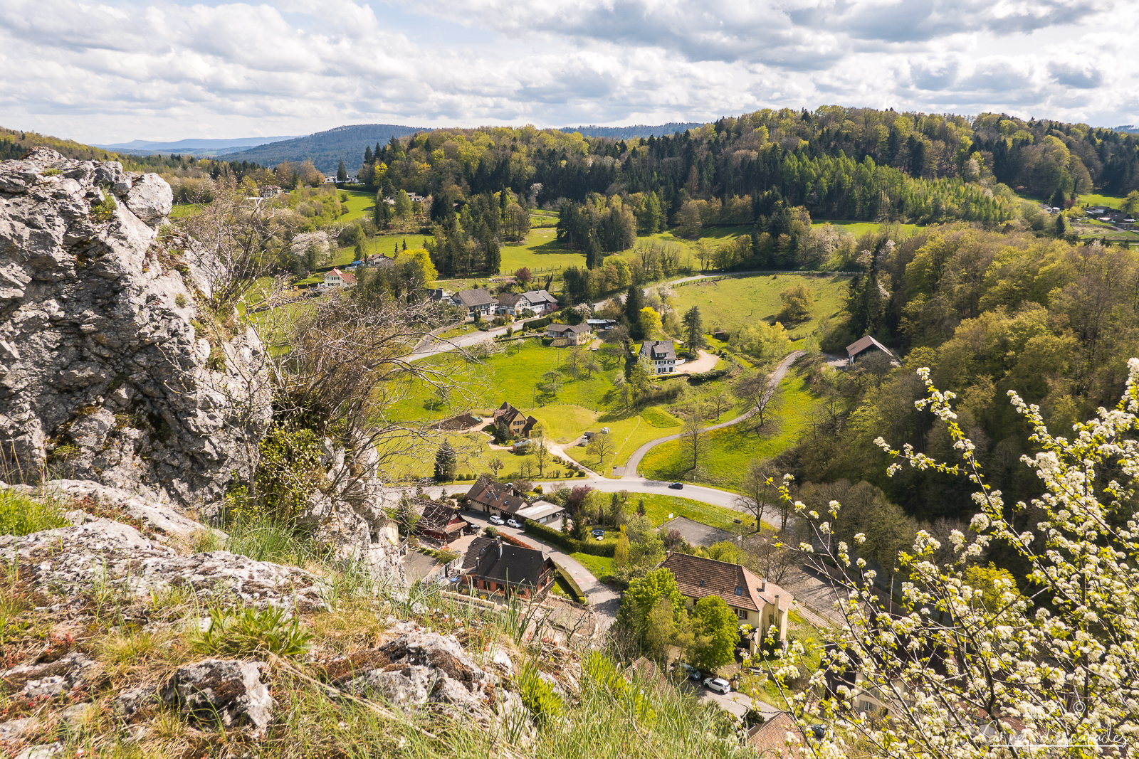
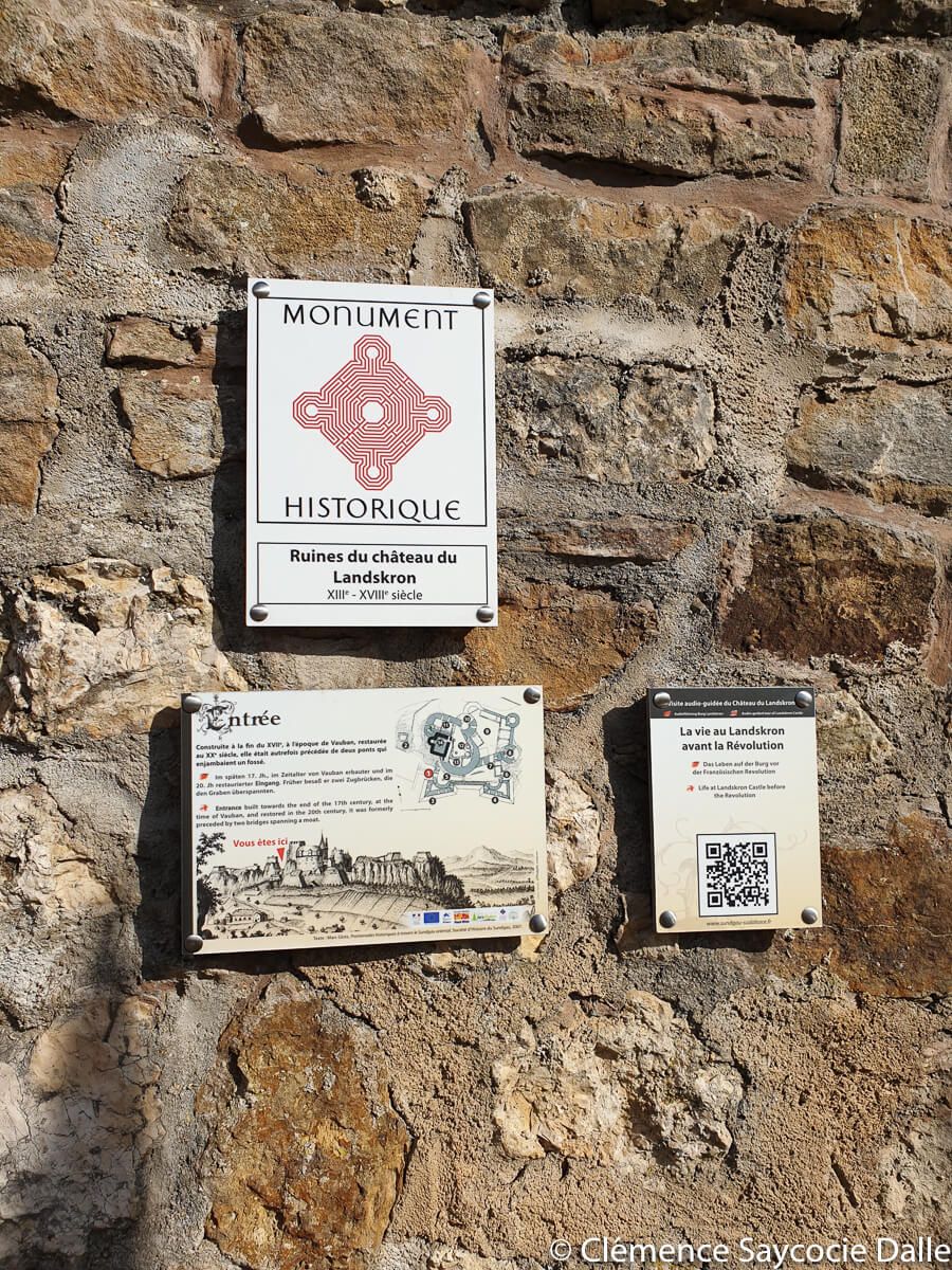
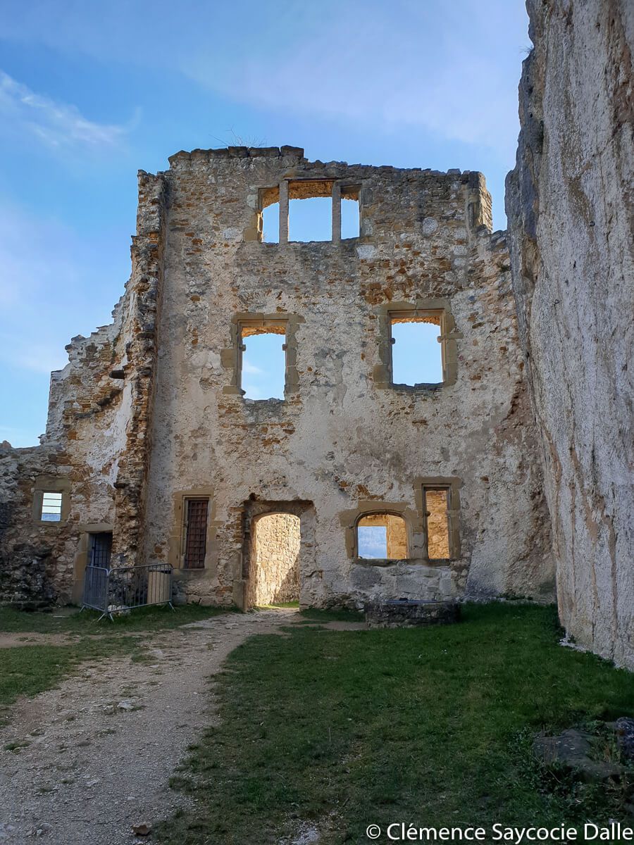
We finally arrive at the castle, which is a listed historical monument. For history fans, his is very interesting: take your time to read the panels in each part of the castle with dates, anecdotes, a general plan… You can also flash the QR-Codes! The ruins, very well maintained by the Franco-Swiss association Pro-Landskron, date from the 13th to the 18th century. The castle served as a residence for the Basel nobility, passed through many hands and ended up as a fortress and prison on the French side. A certain Vauban left his mark there. It is also said that a former nobleman from New Orleans, who had arrived at the court of Versailles, was too forceful with a young lady, causing her to be imprisoned for 21 years (gloups), until the Revolution. The Landskron will be plundered and bombed by the population after the Napoleonic invasions in the early 19th century.
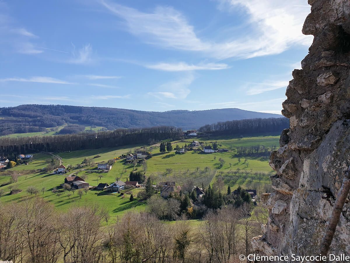
Here, visitors land everywhere. There are many natural terraces that are great for a snack or a picnic. It is safe to walk around (keeping an eye on the children), even if one passage reserves you its share of adrenaline: the metal and spiral staircases which take you to the top of the tower, itself on a rock. The view is magnificent, you can really see all the surroundings and especially the Swiss countryside and the big city next door: Basel.
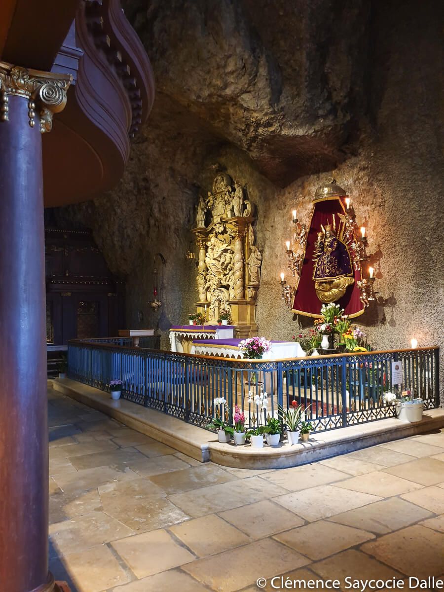
Mariastein and its unique rock chapel!
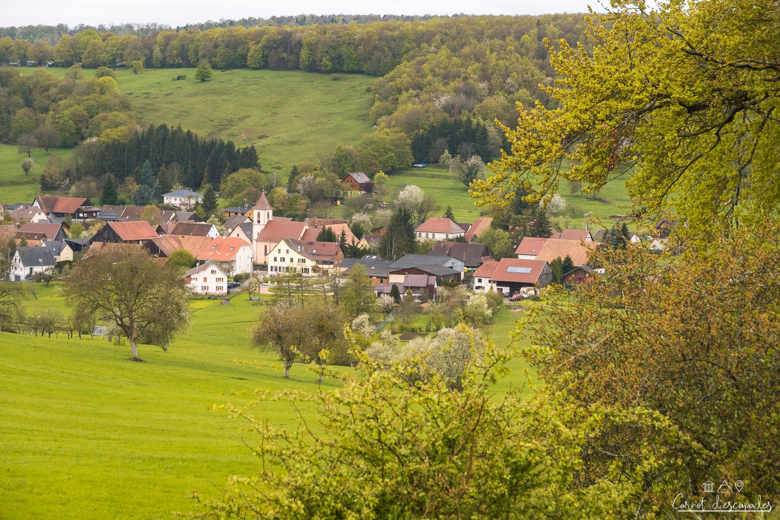
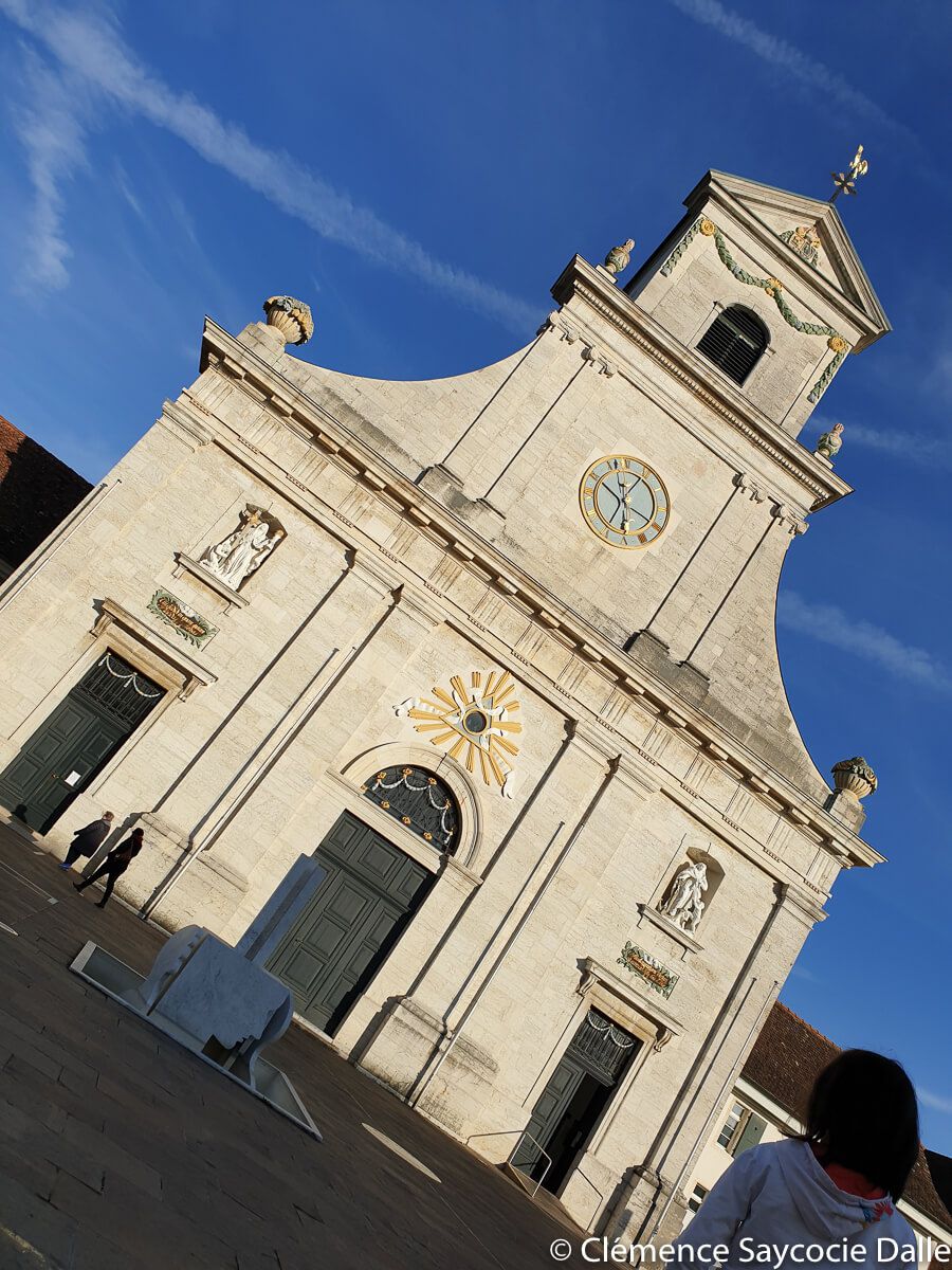
Here we go again! On the way down from the castle, you cross the border into Switzerland without noticing. The view is always so beautiful and the houses, often old farms, are very nicely renovated. On the other side of the hill, we finally see Mariastein, its vineyards and its Kloster (monastery), or “Abbaye de Notre-Dame-de-la-Pierre” in French. The story goes that a family built a chapel in the stone dedicated to Mary in the 15th century, to honor her after she saved their cowherd son from death. Another miracle would have occurred with a knight a few decades later. The legend was born. Today, the place is the object of numerous pilgrimages, in search of a miracle.
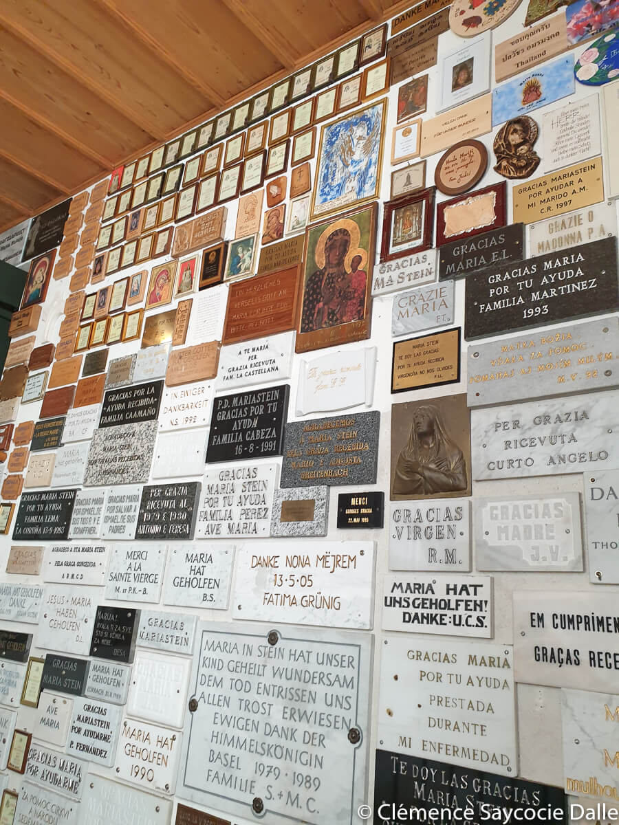
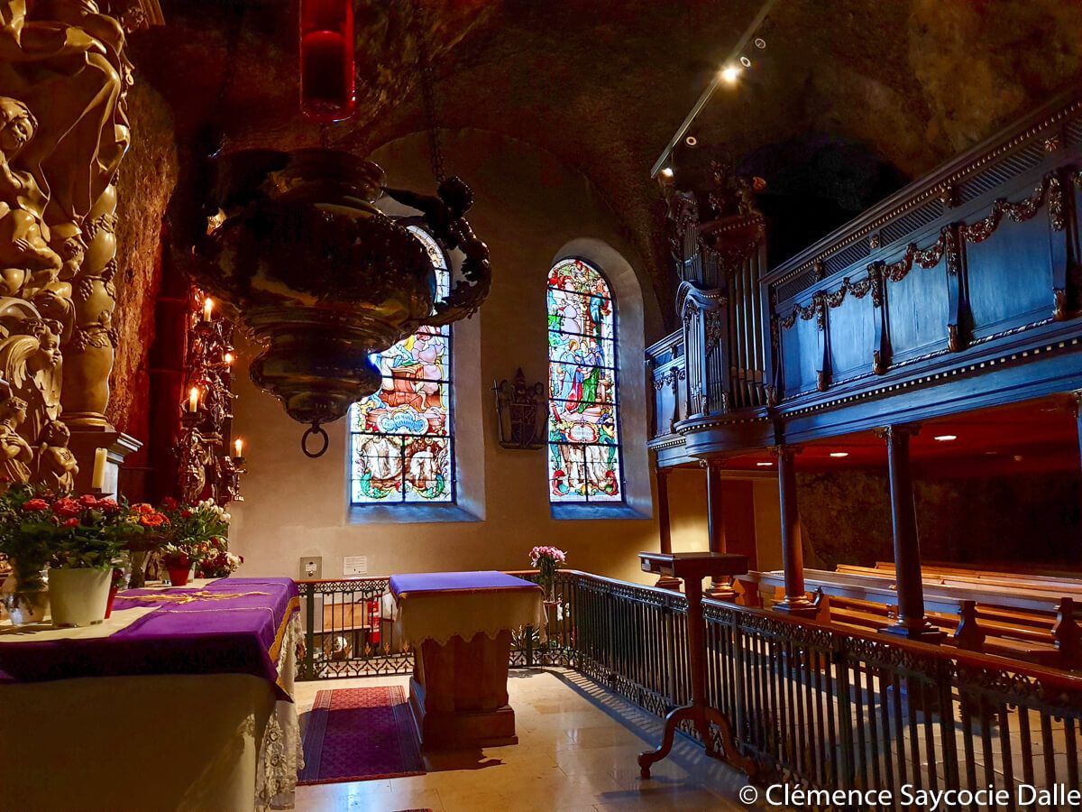
This is evidenced by the hundreds of plaques of thanks in all languages that cover the corridors leading to the sacred chapel. I thought it was beautiful! I had never seen one like it: it is integrated into the monastery but nestled in the rock, with a decoration made of dark wood and gilding, an altar made of stone, a superb statue of Mary and a very beautiful organ. The site is home to the Swiss Benedictine monks’ community and several other chapels.
It is the end of the walk…
After our visit in this timeless chapel, we went back to the Swiss countryside, between fields and forest, then back to the French side (note that the border here is only indicated by a “customs” sign. Not even dotted lines on the ground, I was disappointed 😉 ). In the forest, a “surprise” awaits us: a completely lost cabin (2nd adrenaline moment of the day!). We are going to see quickly what this small house looks like, because the big rock just behind is surmounted by the ruins of the former castle of Waldeck, destroyed in the 14th century, and then we leave quickly.
Practical information
Itinerary
You will find on Visorando the route of the hike.
Departure and arrival
Chapel in Leymen, Rue du Landskron
Features
- Distance : 6,6 km
- Vertical drop : 217mètres
- Duration: 3 hours
Access
By car
You have to count:
- 47 km from Mulhouse (about 45 minutes)
- 75 km from Colmar (about 1 hour)
- 147 km from Strasbourg (about 1 hour and 40 minutes)
By public transport
Not obvious but you can always look on Fluo.