Three castles in one hike, with magnificent views, beautiful rocks and trails on the ridges, it makes you want to do it! Let's go to the heights of Dambach-la-Ville and Scherwiller, only 40 minutes from Strasbourg. This 16 km sporty loop hike lasts between 6 and 7 hours, has 800 meters of positive and as much negative altitude difference, so don't neglect your equipment! I really advise you to do the circuit with your smartphone, following the Visorando GPS track because the markings change often.
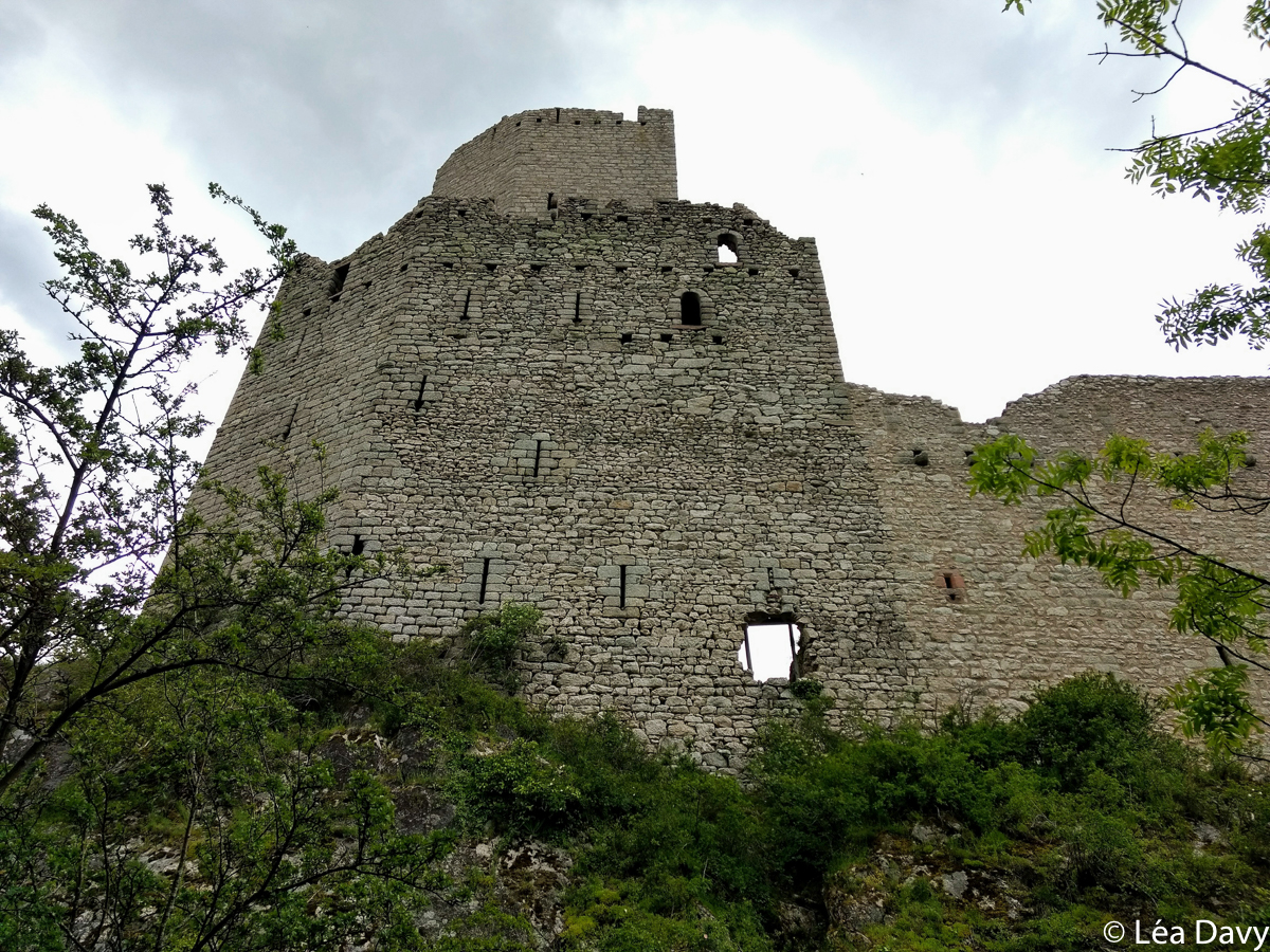
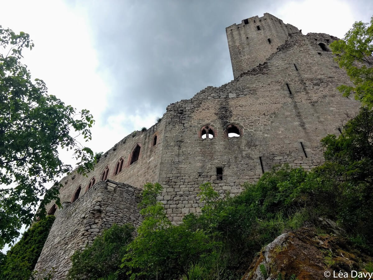
For the departure, park on the parking of the chapel Saint Sebastien and follow the blue disc. The path immediately climbs up through the forest and one quickly reaches the first castle, Bernstein Castle, which is believed to date from the late 12th or early 13th century. According to the legend, the name of the castle comes from the bear family that lived on the rock where the castle was built (“bär” means bear, “stein” means rock, thus Bernstein “bear rock”).
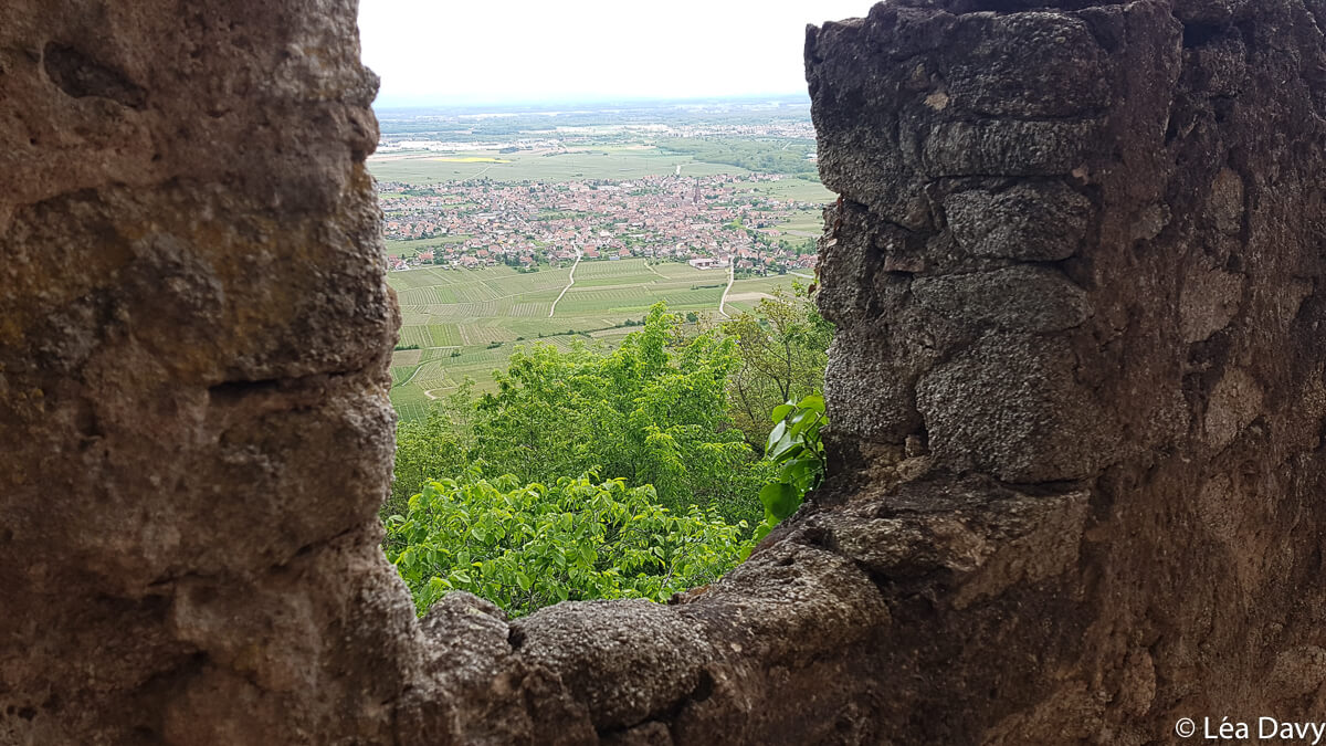
Theassociation of the friends of the Bernstein has been carrying out renovation work since 2010. If you are lucky, you may run into the volunteers. Don’t miss the absolutely magnificent view from the top of the dungeon, over the Alsace plain and the Vosges mountains!
The rocks of Hagelstein, Falkenstein and Gallienstein
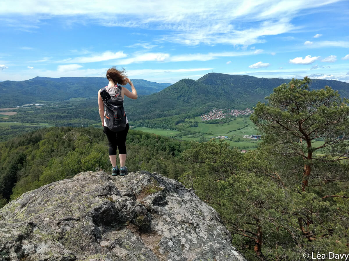
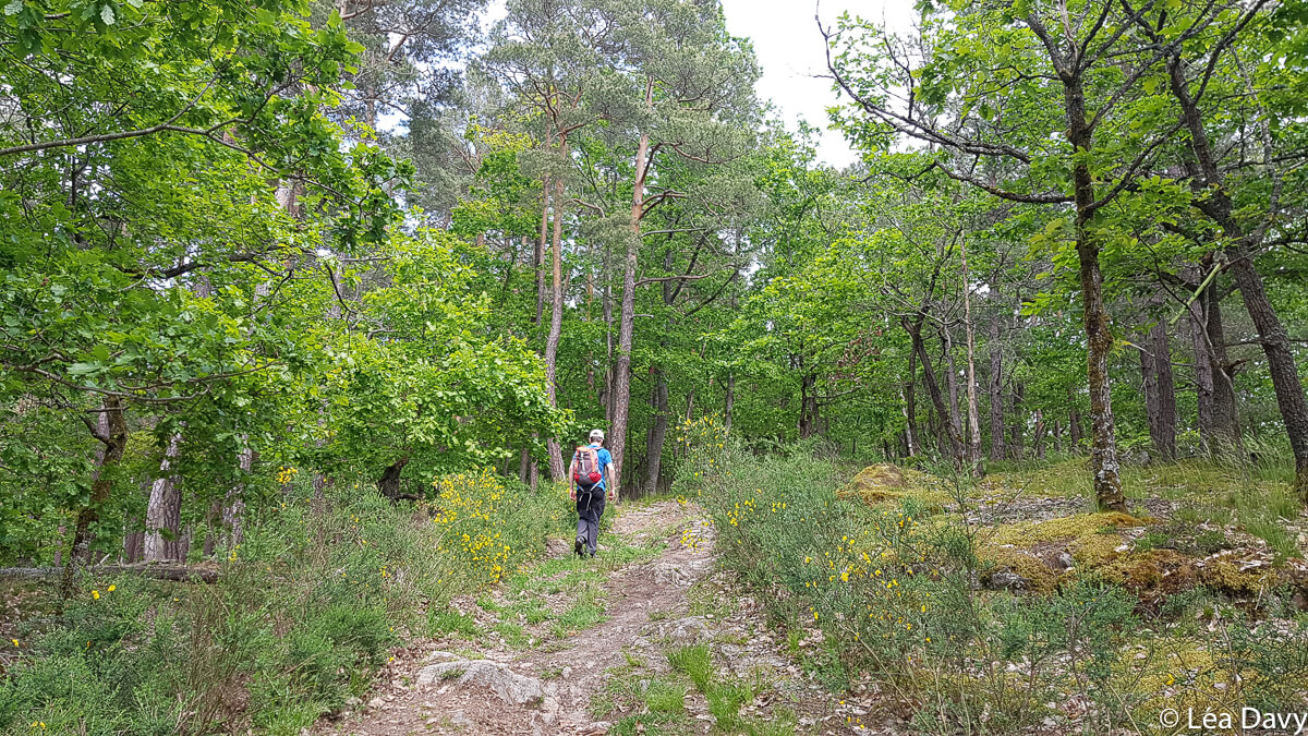
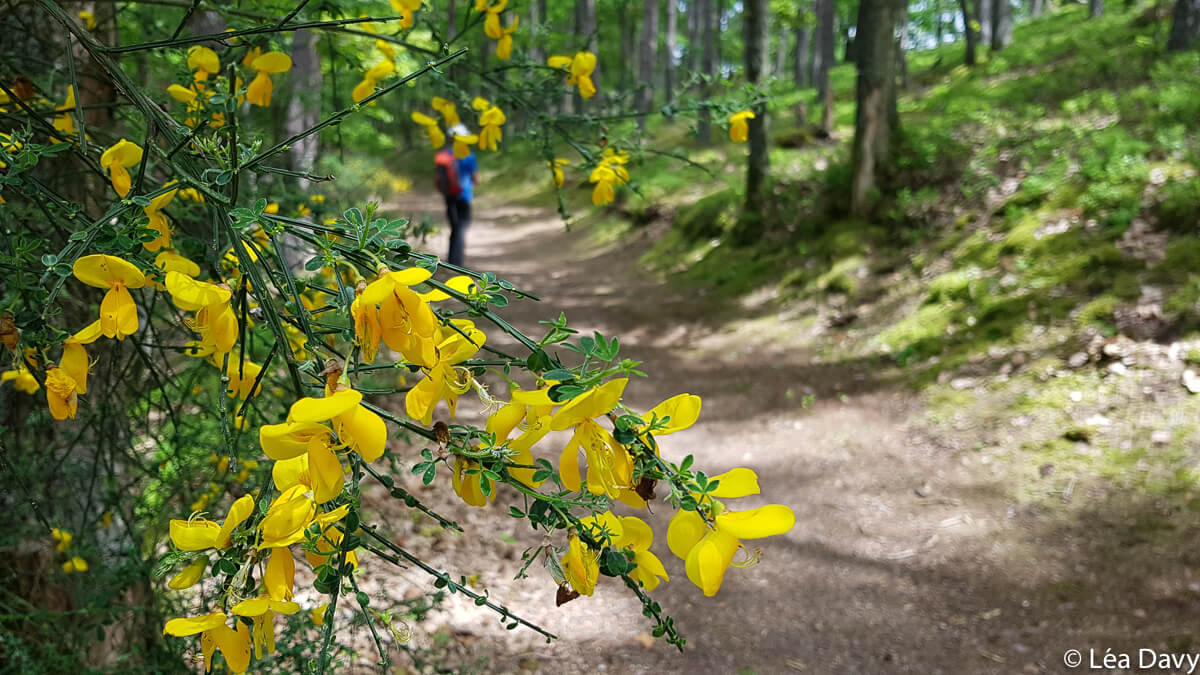
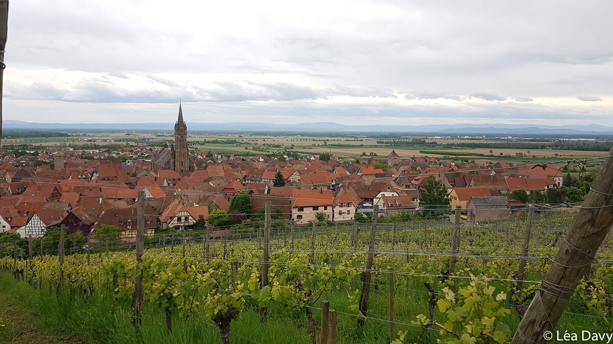
The hike continues to climb through the forest (blue disc markings) and offers nice views. Once at the Stangenberg crossroads, follow the yellow disk signs to the Hagelstein rock and then to the Falkenstein rock. These two sites are really beautiful, with a clear view of the region. And perfect for picnics, as long as you have something to protect yourself from the sun in summer.
Continue towards the Gallienstein rock. The descent is on slightly unstable ground and it is easy to lose sight of the markings, so be careful! The continuation is really pleasant because we are on the crest, often in the shade of beautiful trees and along entanglements of mossy stones, shrubs and flowers.
At the Brischbach crossroads, turn left onto an old salt road. This part of the walk is less interesting because it is flat and a bit monotonous but it is done quickly enough.
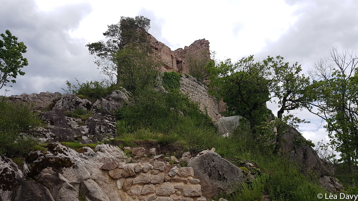
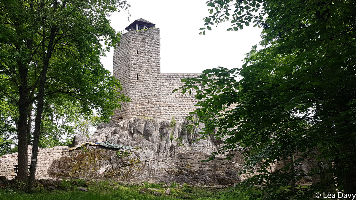
The ruins of Ramstein Castle
It will also be a moment of rest before starting a new climb, on your left, towards the Ramstein castle via the red disc marking.
The site is not visited for security reasons, but it is possible to get close enough to the ruins to admire its wall and its two turrets dating from 1793.
Built in 1293, the castle was destroyed during the 30 years war (1618-1648), like many Alsatian monuments such as the castle of Falkenstein or Landsberg.
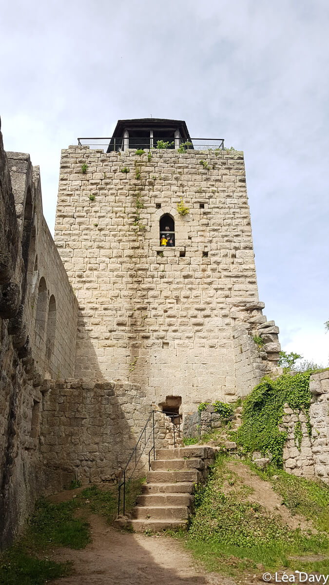
To the Ortenbourg castle
Direction the last castle: the one of Ortenbourg, by taking the GR5 (red rectangle markings). This time, you can enter the ruins (a perfect place for a break) and enjoy beautiful views of the valley from the castle’s niches!
The Ortenbourg castle has had a turbulent history, owned in turn by great families such as the Habsburgs, the Ochsensteins or the Müllenheims, as a result of takeovers or conflicts. It has been classified as a historical monument since 1924 and has belonged to the town of Scherwiller since 1966.
Follow the red rectangle path to the Kriegshurst crossroads and then turn right to follow the yellow disc. A beautiful viewpoint awaits you at the Kaltenberg.
Go back towards the Wiebach crossroads. The trail gently descends through the forest and then the vineyards, until it reaches the chapel, the starting point of the hike.
I liked
- See three castles in one walk
- A circuit with beautiful and varied landscapes
- A sporty hike!
I liked a little less
- The passage on the salt road, quite monotonous
My pictures of the hike to the castles of Bernstein, Ramstein and Ortenburg


Practical information
Departure and arrival
Chapel of Saint Sebastian, Dambach la Ville
Features
- Distance : 16 km
- Elevation gain : 800 meters
- Duration: 7 hours
Access
By car
It is necessary to count approximately:
- 45 km from Strasbourg (about 45 minutes)
- 55 km from Colmar (about 1 hour)
- 95 km from Mulhouse (about 1h15)
By public transport
You can calculate your route on Fluo Grand Est.